Freshwater Biodiversity and Conservation Planning in Cuba
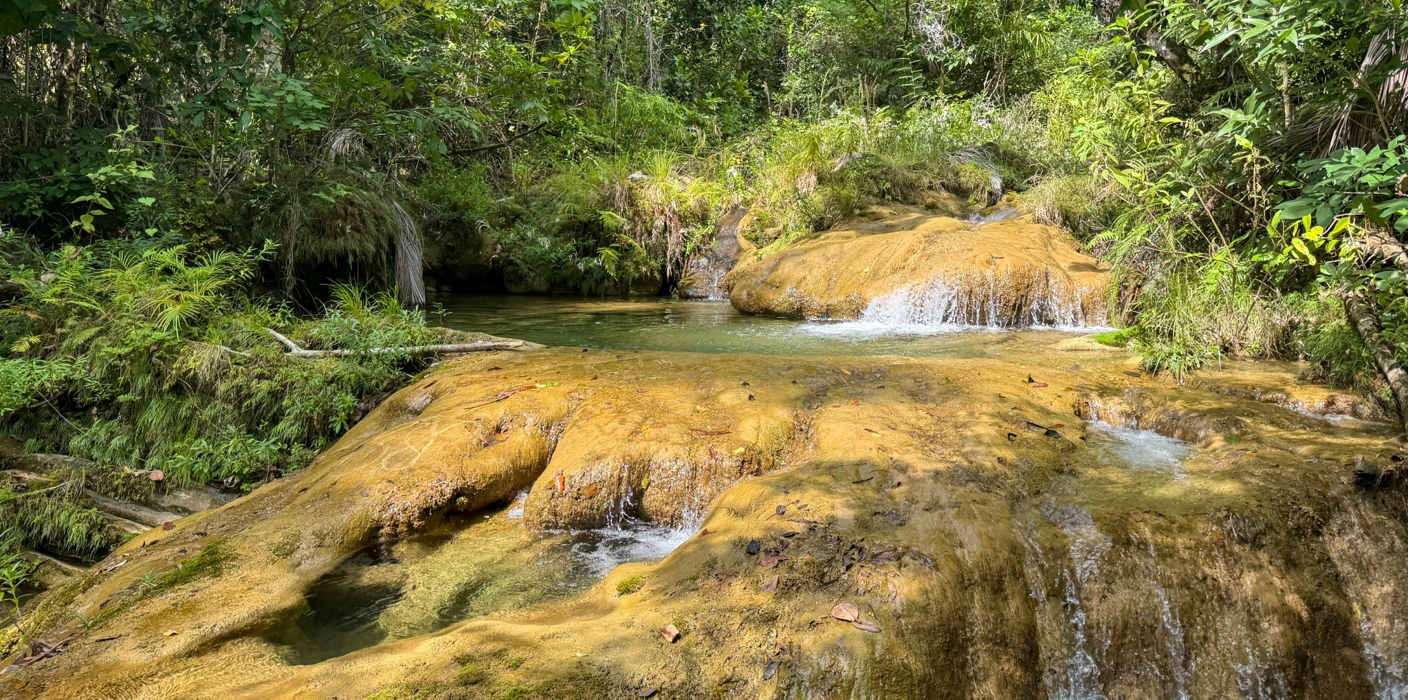
Cuba is part of the Caribbean biodiversity hotspot and supports a diverse freshwater biota with high levels of endemism. Yet, occurrence records have long been scattered across publications, museum collections, and field datasets, limiting their use in large-scale conservation assessments. Our research connects biodiversity data mobilization, species distribution modelling, and spatial conservation planning to ask two related questions: where does Cuban freshwater biodiversity occur, and how well does the current protected-area network represent it?
The project has produced two complementary research outputs:
- A database of freshwater macroinvertebrate occurrence records across Cuba — published in Scientific Data (2023).
- Freshwater biodiversity is not adequately addressed by the current protected areas of the Caribbean biodiversity hotspot — bioRxiv preprint, version posted 14 July 2026 (not yet peer reviewed).
Mobilizing freshwater biodiversity data
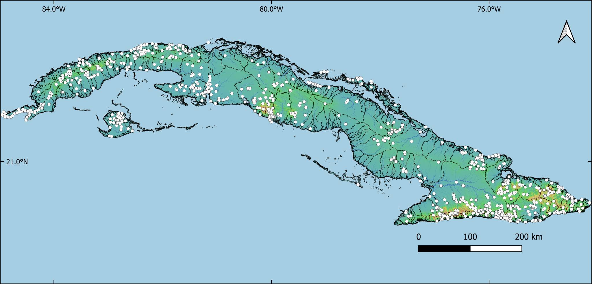
We first assembled and standardized occurrence information for major groups of Cuban freshwater macroinvertebrates, including aquatic insects, freshwater decapods, molluscs, and flatworms. The records came from scientific literature, museums, unpublished field observations, GBIF, and iNaturalist.
The resulting open database contains:
- 6,292 occurrence records representing 457 species
- 1,075 unique localities across 269 drainage basins
- Records spanning 1888–2022
- 32 data fields, including taxonomic, spatial, temporal, and source information, with georeferencing uncertainty documented
The dataset provides a reusable foundation for freshwater biogeography, further field sampling, and spatial biodiversity assessments. It also supports the subsequent conservation-planning study, which incorporated additional fish and aquatic plant records and used a different temporal subset.
» Download the occurrence database (Figshare) «
» Explore the interactive database «
From species distributions to conservation priorities
In the second study, we assessed the representation of 359 freshwater species in Cuba’s National System of Protected Areas (Sistema Nacional de Áreas Protegidas, SNAP):
- 304 freshwater macroinvertebrates
- 31 freshwater fish species
- 24 aquatic macrophytes
We used 130,332 freshwater sub-catchments, derived from Hydrography90m and filtered using mapped water bodies, to characterize species distributions. The occurrence dataset used for this analysis covered 1980–2025. Species with at least 10 occurrence records were modelled using Random Forest and Maxent, together with environmental variables describing climate, topography, hydrology, and human-modified land cover. Models were fitted for 106 species, and predictions for 102 species met the performance criteria for use in conservation planning. For the other 257 species, known occurrence sub-catchments were used to represent suitable habitat rather than extrapolating from poorly supported models.
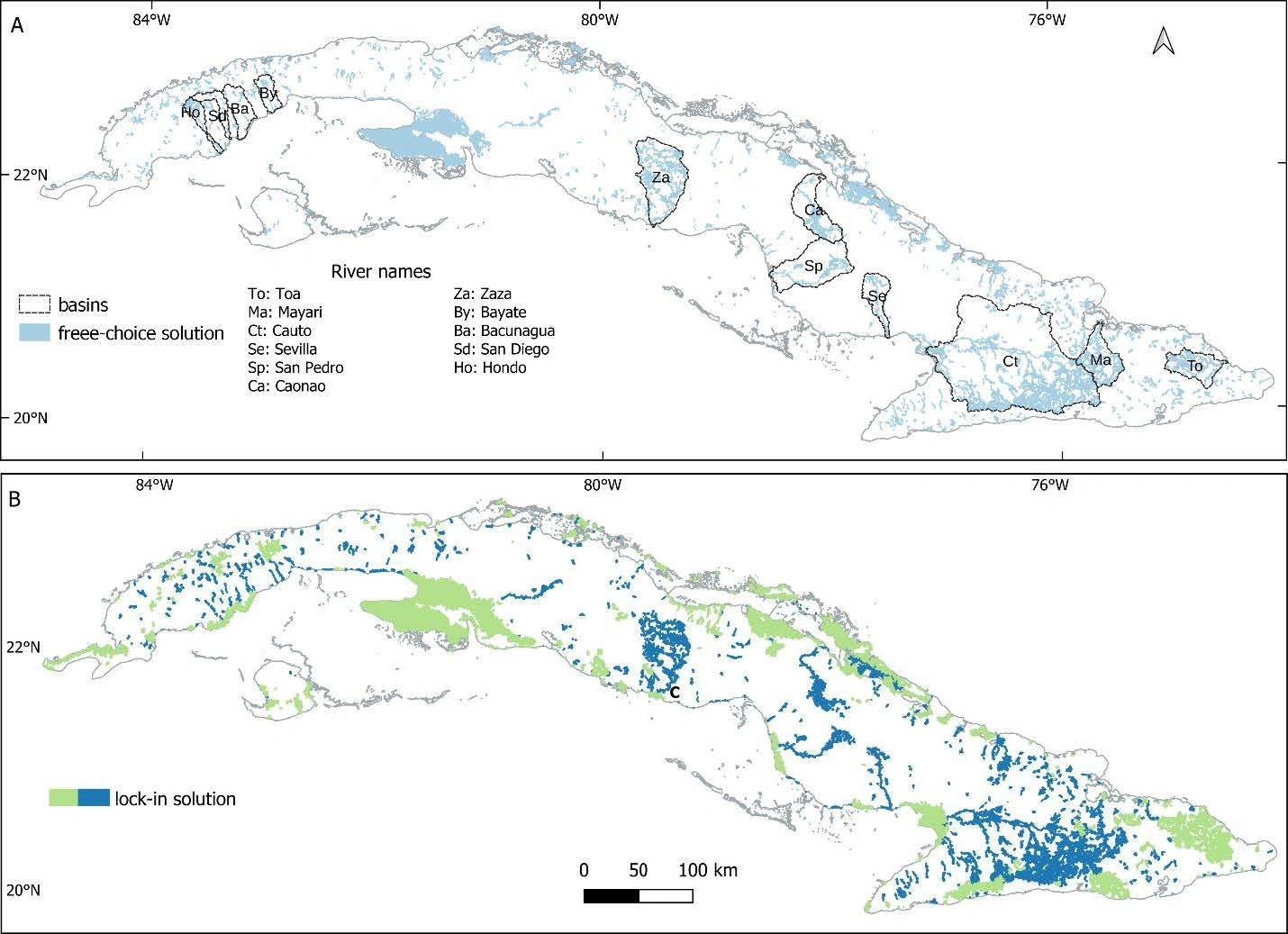
We then used 29,417 larger sub-catchment planning units and systematic conservation planning to find a minimum-cost network that would represent at least 30% of the suitable habitat for every species. We compared the existing SNAP network with two designs:
- Lock-in: retain existing protected-area planning units and select additional units to reach the targets.
- Free-choice: allow any planning unit to be selected, without requiring existing protected areas to remain in the solution.
The analysis used the Human Footprint Index as a proxy for conservation cost (not monetary expenditure) and included a penalty designed to promote longitudinal connectivity along freshwater networks.
Main findings
The existing protected-area system leaves substantial gaps for Cuban freshwater biodiversity:
- 217 of 359 species (60.4%) did not reach the 30% representation target under SNAP.
- The greatest gaps occurred among decapods, aquatic Hemiptera, beetles, and mayflies. Dragonflies, damselflies, and vertebrates were comparatively better represented, although gaps remained.
- Among 106 endemic species not classified as threatened, 67 fell below the target and 33 were entirely absent from SNAP.
- Both prioritization designs achieved the 30% target for all analysed species, but with different trade-offs in area, conservation cost, and species representation.
| Conservation network | Selected freshwater planning-unit area | Median species coverage |
|---|---|---|
| Existing SNAP | 11,159.5 km² (10.2% of Cuba) | 23.1% |
| Lock-in expansion | 18,575.9 km² (16.9%) | 78.2% |
| Free-choice redesign | 13,940.3 km² (12.7%) | 64.9% |
Areas refer to the selected freshwater planning units in the analysis, not the full terrestrial extent of SNAP. Both planning scenarios met the species-level 30% target; median coverage can therefore exceed 30%.
The lock-in solution required approximately 70% more selected area than the current SNAP freshwater network. The free-choice solution reached the same species-level target with less area and lower Human Footprint-based cost. However, practical conservation planning also needs to consider the feasibility of building on existing protected areas.
Hydrological connectivity and priority regions
Both prioritization solutions produced larger connected clusters along the river network than SNAP alone, even though they also contained more separate components overall. In the lock-in scenario, strategically selected stream-network connections in the Cauto and Mayarí basins linked 15 protected areas that were previously disconnected in the network analysis.
Many of the river basins with the highest conservation irreplaceability were concentrated in eastern Cuba, although priority areas also occurred elsewhere. Priority areas differed among taxonomic groups, showing that protecting one group alone is unlikely to represent the entire freshwater biota.
» Read the conservation-planning preprint «
» Access the conservation-planning data (Dryad) «
Conservation implications
The two studies show how open biodiversity data can be translated into spatially explicit conservation evidence. Their findings support targeted expansion of existing protected areas, protection of river corridors and headwater habitats, and more deliberate consideration of hydrological connectivity in conservation decisions. They also reveal the need for further surveys and assessments of poorly sampled freshwater taxa, particularly endemic invertebrates.
The prioritization maps are intended as decision-support tools, not ready-to-implement reserve boundaries: implementation would require engagement with protected-area authorities, water managers, and local communities, as well as consideration of social and institutional constraints.
Publications and data
Torres-Cambas, Y., Megna, Y. S., Salazar-Salina, J. C., Diez, Y. L., Catalá, A., Trapero-Quintana, A. D., Schröder, B., & Domisch, S. (2023). A database of freshwater macroinvertebrate occurrence records across Cuba. Scientific Data, 10, 169.
Publication | Occurrence database | Interactive explorer
Torres-Cambas, Y., Diez, Y. L., Megna, Y. S., Salazar-Salina, J. C., & Domisch, S. (2026). Freshwater biodiversity is not adequately addressed by the current protected areas of the Caribbean biodiversity hotspot. bioRxiv (preprint; version posted 14 July 2026).
Project information
The project was supported by the Alexander von Humboldt Foundation, the Leibniz Competition, and the German Federal Ministry of Education and Research (BMBF).